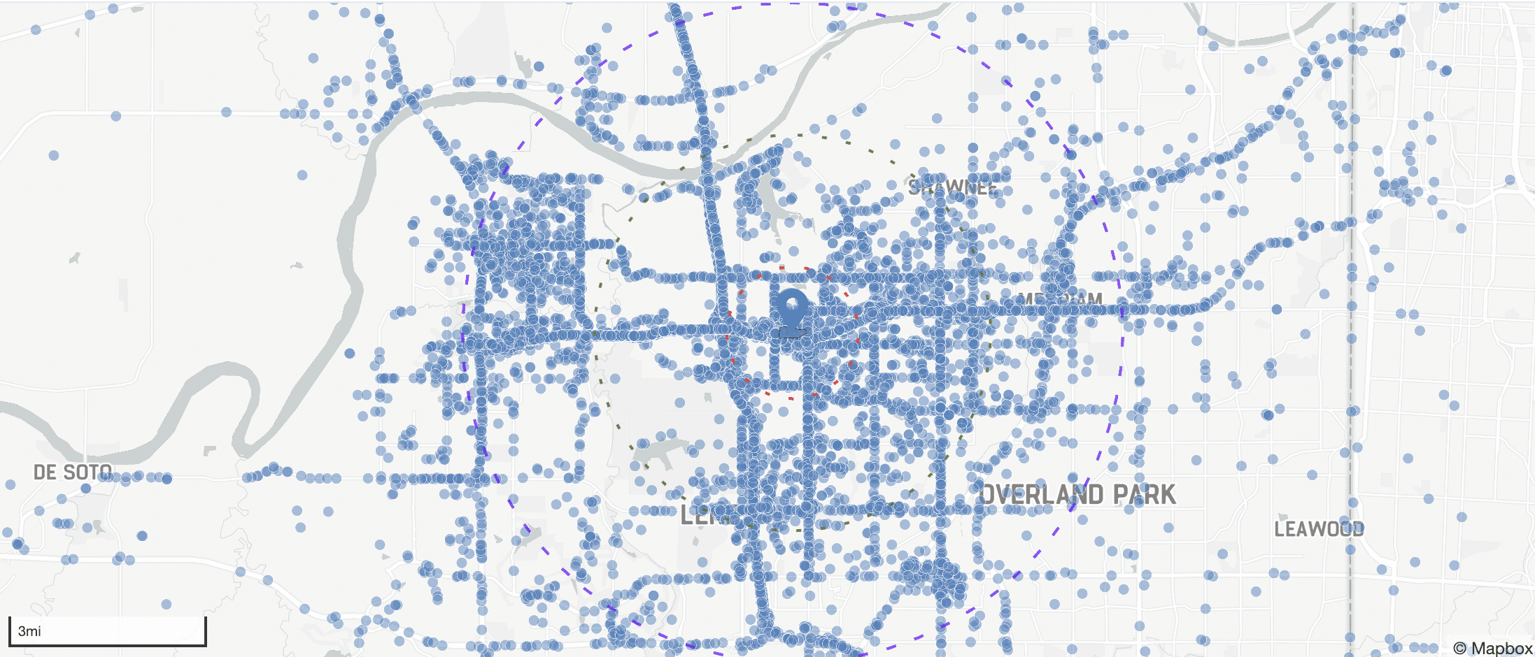
At the heart of Trihelix’s approach lies Blackbox, our proprietary methodology that transforms mobile device location data into actionable intelligence. By leveraging advanced geographic information systems (GIS) and data analytics, Blackbox enables the visualization of audience movements and behaviors, unlocking deeper insights for our clients.
Beyond advertising, Blackbox supports organizations in gathering intent data to uncover hidden patterns and trends. This intelligence informs strategic decisions, whether by identifying audience behaviors in key locations or providing a clearer picture of movement within specific environments.
Through this unique methodology, we transform raw mobile data into meaningful insights, empowering organizations to stay ahead in a location-driven world. With Blackbox as the foundation of our process, Trihelix delivers a competitive edge to clients across industries.
Trihelix introduces a groundbreaking innovation with our patent-pending Floor Level Detection Algorithm, enabling unparalleled accuracy in identifying a device’s exact floor level within multi-story buildings. This revolutionary capability enhances audience segmentation by providing precise insights into user movements and behaviors within specific floors of a location.
The applications of this technology extend far beyond advertising. In law enforcement and special operations forces, understanding an individual’s exact location within a building can improve situational awareness and operational planning. Emergency response teams can use this technology to locate individuals in need of assistance more effectively, ensuring faster and more accurate interventions during critical situations.
Whether it’s segmenting audiences for targeted engagement or providing actionable intelligence for mission-critical operations, the Floor Level Detection Algorithm redefines how we leverage location data. By integrating this advanced capability, Trihelix empowers organizations to act with greater precision, setting a new standard in location-based intelligence across industries.
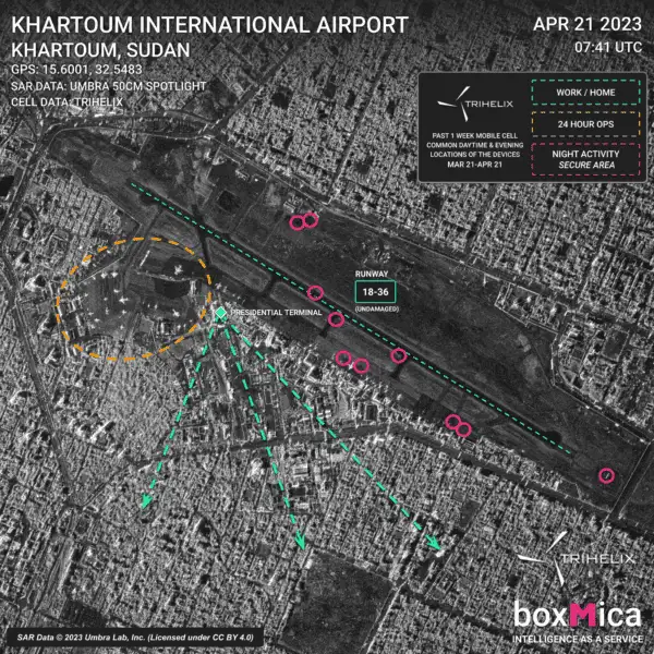
Trihelix combines mobile device location data with upscaled high-resolution satellite imagery, providing clients with a cost-effective solution without compromising on data quality. Our proprietary super-resolution algorithm enhances low-resolution satellite imagery, delivering crystal-clear visuals that reveal hidden patterns and insights. This innovative process allows clients to reduce expenses while accessing the highest quality geospatial data available.
By integrating mobile location data with enhanced satellite imagery, we uncover unseen data points that companies can leverage to gain a competitive advantage. For disaster response, this capability can highlight overlooked regions requiring urgent aid. Urban planners can identify previously undetected movement patterns, enabling smarter infrastructure development. In defense and security, detailed imagery layered with mobile data provides mission-critical intelligence, offering a clearer understanding of operational environments.
This fusion of mobile data and advanced satellite imagery enables organizations to move beyond raw data, revealing actionable insights that drive strategic decisions. With Trihelix, clients gain access to powerful tools that redefine the possibilities of geospatial intelligence.